Smart Level Book: Utility Tool for Land Surveyors
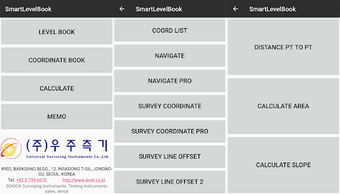
Smart Level Book is a comprehensive utility tool designed for land surveyors, offering features such as real-time ground level calculation, coordinate measurement, stake-out predictions, distance calculations, area calculations, volume calculations, slope calculations, and note management. The app simplifies the surveying process by allowing users to calculate ground height by entering Backsight (BS) and Foresight (FS) without the need for a separate calculator. It also enables the storage and loading of level survey data, Excel file outputs, and prediction of point directions during stake-out.
Coordinate Field functionality includes predicting point directions, calculating azimuths, distances, and coordinates between points, as well as managing left/right offset coordinates of stations. It provides accurate measurements even in GPS-challenged locations. The app also facilitates note input, management, and recall, making it a versatile tool for surveying professionals.